Thursday, 30 March 2017

Northwest Territories,Yukon and Nunavut


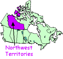
NORTHWEST TERRITORIES is the central Canadian territory.  Yellowknife is the capital city.
Up until, 1999 the Northwest Territories were twice the size.  On April 1, 1999, it was split to recognize Nunavut as a separate territory.
Check out our brief photo tour of the Northwest Territories if you'd like to see more of the scenery of the territory or if you need photos for a school project.


  • The government made French an official language for these territories. Although they have their mother tongue, the "Dogrib".
  • Some of the major cities in Northwest Territories are Yellow Knife, Hay River, Inuvik …
  • One of the main sites of interest is the capital "YellowKnife" in which you will have no problem to communicate because they speak 5 lenguages.
  • One of the most expected events is the aurora borealis.
  • One of the things people go to Northwest Territories is to visit the "Diavik", a diamond mine from which the purest diamonds in the world are extracted.


NUNAVUT is the eastern-most Canadian territory.  Iqaluit is the capital city.
Up until, 1999 Nunavut didn't exist.  On April 1, 1999, the eastern portion of the Northwest Territories was carved out and the territory of Nunavut was born.Yukon is the western-most Canadian territory.  Whitehorse is the capital city.

  • The lenguaje that they use is inuktit because most of the people can´t speak in english or french.
  • The main citiy in Nunavut is the capital called “Iqaluit”.
  • Alert is a small village situated on the coast of the Isle of Ellesmere. That it is actually a Canadian military base
  • The main event in Nunavut is "Spring Ice" which has an Eskimo origin and in which there are competitions of fishing and dog races.
  • In Nunavut there are several places of interest but the most outstanding are: "Mount Thor", "Hudson Bay Company".


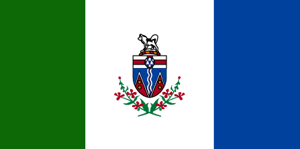
THE YUKON TERRITORY is bordered on the Western side by the U.S.  State of Alaska.  To the north is the Beaufort Sea and to the south is the Province of British Colum.

  • Being a federal territory the official languages are English and French.
  • The main cities are Whitehorse which is it´s the capital and Dawson City and Watson Lake among others.
  • In Yukon there are several sites such as the Yukon Beringia Interpretive Center or the museum of mining, hot springs, hiking …
  • There are several ways to have fun in Yukon: by mountain bike trails, gold mines, and rafting on the Alley Glacier.






QUEBEC

Quebec

Resultado de imagen de quebec mapGEOGRAPHY


Quebec is the largest province and it's found on the east of Canada.
Quebec city is its capital, and the most popular city is Montreal.


HISTORY

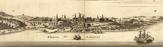
The first inhabitants were American indians and Inuit. In 1534 French explorer Jacques Cartier   took possession of the land. For the next 75 years Quebec was visited by fishers.


In 1608 Samuel de Champlain founded the city of Quebec and established the first permanent colony. Montreal was founded in 1642.


The final battle between the French and British for possession of the New World was fought on the Plains of Abraham at the city of Quebec in 1759. The battle was part of the French and Indian War. At the end of the war Canada was ceded to Great Britain.


In the 1960s agitation broke out to separate Quebec from Canada and set up a new French-speaking country. In 1974 French was declared the official language of the province.


NAME ORIGIN
If you want to know why Quebec is called Quebec it’s because ,“Quebec” comes from the Algonquin word for “narrow passage” or “strait”. It was first used to describe the narrowing of the St. Lawrence River near where is now the City of Québec.


LANGUAGES

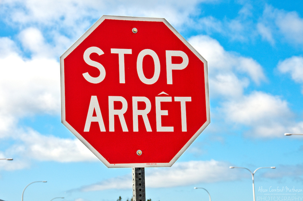
-Going to Quebec is a fantastic experience but if you want to make the most of it you should speak French. French is the only official language in Quebec. But if you don’t speak French and you know English, don’t worry! There won’t be any problem.


-Canadian French shows many differences with the one spoken in France.This video has some of them: https://www.youtube.com/watch?v=tF46rEE5yZU


-Also there are some differences between French and English speakers canadians.Here we've got some of them: https://www.youtube.com/watch?v=BnwhezOlvqg

MAIN CITIES OF QUEBEC

Quebec is a beautiful region full of amazing cities which you can visit, here we have the main cities placed in Quebec.


1.Montreal- With 1,704,694 inhabitants is  the most popular city  in Quebec and the  2nd-most popular in Canada. The city occupies most of the Island of Montreal.


2.Quebec City- With 531,902 inhabitants is the capital city of the Canadian province of Quebec,it’s Canada's seventh-largest metropolitan area and Quebec's second-largest city after Montreal.

3.Laval- With 401,553 inhabitants is a Canadian city in southwestern Quebec, north of Montreal.It is the largest suburb of Montreal, the third largest municipality in the province of Quebec.

Montreal
Laval
Quebec


Here a video explaining the largest and more important cities: https://www.youtube.com/watch?v=Y_ijOlPgHFQ


LANDMARKS IN QUEBEC

Visiting Quebec it’s a fantastic experience in which you can learn about Quebec’s culture by visiting its most important landmarks such as:


1- Notre-Dame Basilica: is a basilica in the historic district of Old Montreal, in Montreal.The church is located at 110 Notre-Dame Street West, at the corner of Saint Sulpice Street. It is located next to the Saint-Sulpice Seminary and faces the Place d'Armes square.Built in the Gothic Revival style, the church's is highly decorated.


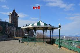
2- Terrasse Dufferin: is a terrace that wraps around the Château Frontenac in Quebec City, overlooking the St. Lawrence. It was built in 1879 under the direction of Lord Dufferin, the then Governor-general of Canada.


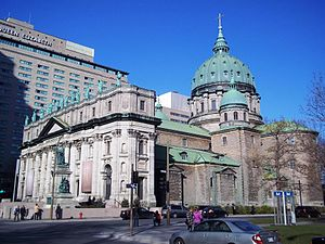
3- Mary, Queen of the World Cathedral: is a minor basilica in Montreal, Quebec, Canada, and the seat of the Roman Catholic archdiocese of Montreal. It is the third largest church in Quebec. The building is 101 m (333 ft) in length, 46 m (150 ft) in width, and a maximum height of 77 m (252 ft) at the cupola, the diameter of which is 23 m (75 f
 

EVENTS AND FESTIVALS

Carnival in Quebec

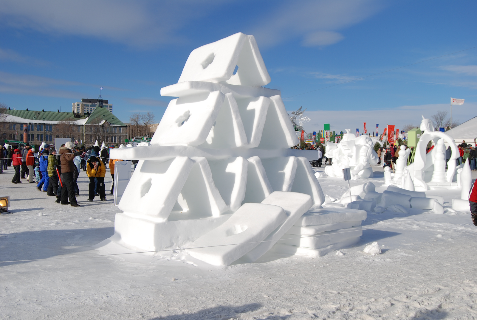
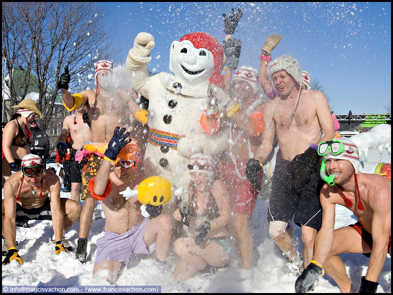
If you visit Quebec during the winter you should go to the Carnival, a very popular festival celebrated each year for 17 days. People transform the city into a beautiful winter wonderland: they build snow statues and castles and they participate in races and games.


But the most famous events are the nighttime and daytime parades, where the main character is… a snowman! It's the mascot of this Carnival and its name is Bonhomme Carnaval. For the parades the city is decorated with lights and more ice sculptures. Also numerous parties, shows and balls are performanced across the city.


Fetes de la nouvelle-France

Every August they celebrate during five days the life of the european settlers of Quebec on the 17th century in the Fetes De La Nouvelle-France (New France Festival). The event is known for its performances, parades, stories, dancing and f other cultural activities.


To celebrate this festival, people dress up as peasants, nobles and bourgeoisie while taking part in festival activities. So you can wear traditional clothes and you can feel as if you were 400 years ago. https://www.youtube.com/watch?v=W2I6GZpUl0I


Festival montréal en lumière

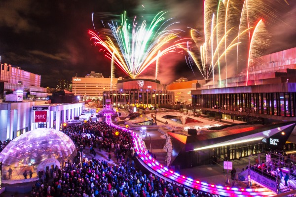
In Canada winters can be very long and cold but at the end of February, in Montreal, it takes place a festival to celebrate that winter is near the end: Festival montréal en lumière.


During 11 days the city is full of lights, and at nights they throw fireworks to illuminate the night sky. There are also many activities that you can do with family and friends like ice skating or maybe you can go to a concert or participate in a performance.


FUN, WEIRD AND INTERESTING FACTS:


If you want to have fun and enjoy your travel in Quebec you should go to this event:

Festival d´ete de Quebec

This summer festival has been taking place annually since 1968 in Plains of Abraham, a historic area within The Battlefields Park in Quebec City. If you come you´ll listen to pop, rock, folk electronic and hip hop music. Also important groups as The Rolling Stones, Iron Maiden or Metallica have played in this festival!


Some interesting facts: https://www.youtube.com/watch?v=cQV_f9UFaCI


  • Only about 1.5% of the population speaks English. Over 95% of the population is French speaking. But more than a third of the population can speak both English and French.


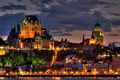
  • The Chateau Frontenac is the world’s most photographed hotel.


  • On the winter solstice the sun rises at 7:27 am and sets at 3:59 pm.


  • On the summer solstice the sun rises at 4:51 am and sets at 8:43 pm.


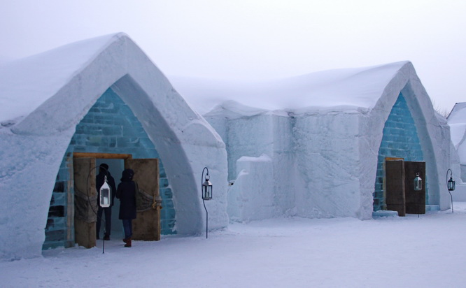
  • The Hôtel de Glace in Quebec City (the only ice hotel in North America) requires 30 thousand tons of snow to build and 500 tons of ice and the inside temperature for sleeping is between -3°C and -5°C! You must wrap up if you want to sleep there!


THINGS TO DO IN QUEBEC

Here you've got two videos with different places you can visit in Quebec city and in Montreal.

Quebec city:

Montreal:

https://www.youtube.com/watch?v=poe2cLKw9ko


By Lucía Castro Narciandi and Berta Fernández Vior  4ºA

ONTARIO

Ontario located in East-central Canada, it’s the most populous province in Canada. It is home to nation’s capital city, Ottawa and to one of the most important Canadian cities, Toronto.

English is the official language, but many people speak French too.

As it is a large province, the weather depends on where you are. Usually January is the coldest month of the year, and July is the warmest. Spring is a rainy season in most parts of Ontario, so maybe you want to avoid it when you go.

There are very interesting places and festivals to visit in Ontario:

NIAGARA FALLS
Niagara waterfalls are one of the most impressive landmarks in Canada.

If you want to spend a wonderful day visiting the waterfalls, you can go for a boat tour, or, if you prefer a sky view, you can take a helicopter.

If you visit them during winter, you will enjoy an amazing light and fireworks show.

Resultado de imagen de NIAGARA FALLS WINTER LIGHT FESTIVAL

KILLARNEY PROVINCIAL PARK

Do you like spending time in nature? Then, you should definitely go to Killarney Provincial Park. It offers numerous canoe routes, as well as hiking trails, camping sites…

Killarney Provincial Park


POW WOW IN MANITOULIN
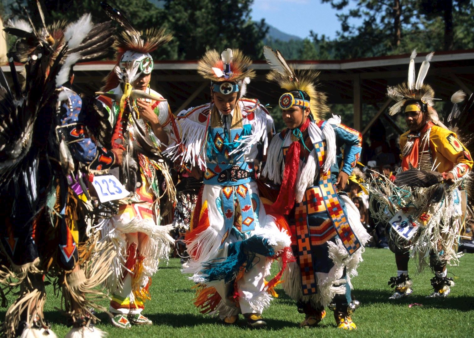
In August, the Wikwemikong Indian reserve welcomes visitors to celebrate their culture through dancing and music. This festival has it all,  from local food to a dance competition, which showcases adorned outfits covered in colorful feathers.


CN TOWER
A cool place to visit in Toronto is the CN Tower.

Imagen relacionada

At the top you have a great view over the city and, if you wait till night, they get even better, since the whole city is illuminated.

Resultado de imagen de cn tower night views

PARLIAMENT HILL
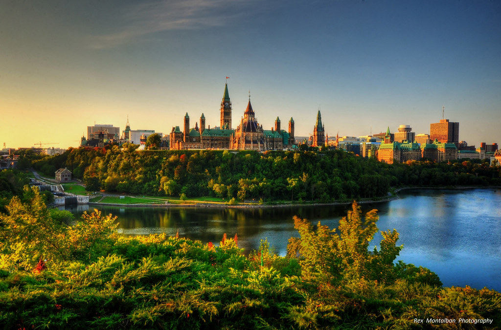
The Parliament Buildings are set on a hill overlooking the Ottawa river. They are a beautiful group of buildings, example of Gothic Revival architecture.

Resultado de imagen de parliament hill

In front of them, there’s the Centennial Flame, which commemorates Canada’s 100th anniversary as a Confederation.

Imagen relacionada

Each morning, during summer months, you can see the Changing of the Guard ceremony.

NATIONAL GALLERY OF CANADA

If you like art, you should spend a day at Canada’s National Gallery, one of the most important art museums in America. It has a large collection of paintings, sculptures and photographs. The contemporary art collection stands out.

Resultado de imagen de NATIONAL GALLERY OF CANADA

Saskatchewan


Saskatchewan

Capital Regina
Largest city Saskatoon
Area
• Total 651,900 km2 (251,700 sq mi)
• Land 591,670 km2 (228,450 sq mi)
• Water 59,366 km2 (22,921 sq mi)  9.1%
6.5% of Canada
Population
• Total 1,098,352
• Density 1.9/km^2 (5/sq mi)
Official languages English
• Total (2015) C$79.415 billion
• Per ca-pita C$70,138 (4th)
Saskatchewan is a prairie and arboreal province in west-central Canada, the only province without natural borders. It has an area of 651,900 square kilometers (251,700 sq mi), nearly 10 percent of which (59,366 square kilometers (22,900 sq mi)) is fresh water, composed mostly of rivers, reservoirs, and the province's 100,000 lakes.
Saskatchewan is bordered on the west by Alberta, on the north by the Northwest Territories, on the east by Manitoba, to the northeast by Nunavut, and on the south by the U.S. states of Montana and North Dakota.
Saskatchewan is a landlocked province with large distances to moderating bodies of waters. As a result, its climate is extremely continental, rendering severe winters throughout the province. Southern areas have very warm or hot summers. Midale and Yellow Grass near the U.S. border are tied for the highest ever recorded temperatures in Canada with 45 °C (113 °F) observed at both locations on July 5, 1937. In winter, temperatures below −45 °C (−49 °F) are possible even in the south during extreme cold snaps.


Saskatchewan has been inhabited for thousands of years by various indigenous groups, and first explored by Europeans in 1690 and settled in 1774. It became a province in 1905, carved out from the vast North-West Territories, which had until then included most of the Canadian Prairies. In the early 20th century the province became known as a stronghold for Canadian social democracy.
Etymology
Its name derived from the Saskatchewan River.
Geography
As Saskatchewan's borders largely follow the geographic coordinates of longitude and latitude, the province is roughly a quadrilateral, or a shape with four sides. However the 49th parallel boundary and the 60th northern border appear curved on globes and many maps. Additionally, the eastern boundary of the province is partially crooked rather than following a line of longitude, as correction lines were devised by surveyors prior to the homestead program (1880–1928).
Saskatchewan contains two major natural regions: the Canadian Shield in the north and the Interior Plains in the south. Northern Saskatchewan is mostly covered by arboreal forest except for the Lake Athabasca Sand Dunes, the largest active sand dunes in the world north of 58°, and adjacent to the southern shore of Lake Athabasca. Southern Saskatchewan contains another area with sand dunes known as the "Great Sand Hills" covering over 300 square kilometers (120 sq mi). The Cypress Hills, located in the southwestern corner of Saskatchewan and Killdeer Badlands (Grasslands National Park), are areas of the province that were unglaciated during the last glaciation period, the Wisconsin glaciation.
The province's highest point, at 1,392 meters (4,567 ft), is located in the Cypress Hills less than 2 km from the provincial boundary with Alberta. The lowest point is the shore of Lake Athabasca, at 213 meters (699 ft).
Climate
Saskatchewan receives more hours of sunshine than any other Canadian province. The province lies far from any significant body of water. This fact, combined with its northerly latitude, gives it a warm summer, corresponding to its humid continental climate in the central and most of the eastern parts of the province, as well as the Cypress Hills.
Saskatchewan is one of the most tornado-active parts in Canada, averaging roughly 12 to 18 tornadoes per year, some violent. In 2012, 33 tornadoes were reported in the province.

The hottest temperature ever recorded anywhere in Canada happened in Saskatchewan. The temperature rose to 45 °C (113 °F) in Midale and Yellow Grass. The coldest ever recorded in the province was −56.7 °C (−70.1 °F) in Prince Albert, which is north of Saskatoon.


Resultado de imagen de saskatchewan

Resultado de imagen de saskatchewan


Resultado de imagen de saskatchewan